

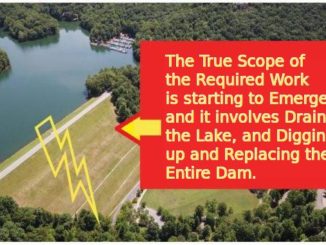
FOBC has obtained responses to Open Records Requests that include the latest Draft of the Lake Petit Dam Emergency Action Plan (“EAP”). It is a large file, 159 Pgs; 15.6 Mb.
For people in Big Canoe, Cove Lake and Marble Hill area just wanting to know if their property is in the Impact Zone in the event the Petit Dam were to fail, here is a smaller 6 page excerpt that lists the parcels – 6 Page EAP Affected Parcels List. It contains Table 4 (Parcels Impacted) and Table 5 (Structures Flooded). Of note is that Table 4 talks about “downstream” parcels, but also includes many properties around Lake Petit. Those are parcels that have risks associated to landslides around the edge of the lake in case of rapid drawdown (due to the steep slope cuts made when originally digging out the lake basin.)
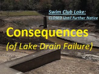
Note that Cove Road between Cove Lake and Steve Tate will also be washed out, and that water service in much of Big Canoe and the surrounding area (if you rely on County Water supplied by Big Canoe) will be gone as well. Sewer & subsequent Water Treatment facilities in the areas served within Big Canoe will be gone also. These longer term consequences are not directly referenced in the EAP. Attached is a marked up map of potentially affected water customers in East Pickens. Pickens Co Water Lines fed by Big Canoe Reservoir.
After receiving the Draft EAP, FOBC sent 3 emails to Ga Safe Dams outlining concerns with the legitimacy and regulatory compliance of the document. Email #1 (included GSD Response); Email #2 (Additional Testing Concerns); Email #3 (Communications Issues Noted).
The above Email Comments had been taken into consideration by Ga Safe Dams, which sent a January 7, 2022 Letter to Geosyntec listing 8 Points of Deficiency that needed to be corrected prior to acceptance of the EAP, and 4 other items that needed strong consideration.
All the documents speak for themselves. Most people won’t read any of this, probably not beyond the brief list of affected properties. Hopefully those few qualified persons in the Community and Surrounding areas that may have engineering or regulatory background WILL fully consider these documents, and continue the process of holding Big Canoe Management accountable, and demand some explanations.
Below are some beginning questions that I believe need clarification:
(1) Referencing my Email #2, it is of note that Immediately after the sending of that email…. Big Canoe stopped drawing down the levels of Lake Petit. No explanations. Did that Email #2 hit a nerve with Ga Safe Dams? Were they indeed not aware of Big Canoe’s actions, and was there concern expressed that the POA was attempting to manipulate Quarterly & Seismic Testing responsibilities? Were they subsequently “caught int he act” and forced to get into compliance with an accepted timeline for procedures? Some honesty and public explanation of WHY the draining of the Lake stopped seems appropriate.
(2) Regarding Email #3, why are Dawson County Properties that surround the Lake not included in the notification process? By going out of protocol and putting this all on Pickens County EMS, you ignore those Dawson County lakefront properties that are also at risk of destabilization. The Pickens Parcels are listed. Why are the affected Dawson Parcels NOT? Possibly a problem with B.C. foisting their legal responsibilities off on Pickens EMS?
(3) Email #1 points out several serious issues. I will focus on just one… the fact that documentation exists going back to a letter on December 11, 2017 (see Item 7), and subsequent delay letters on Jan 30, 2018, and more Stern Overdue Warnings on May 10, 2018 that this issue goes back over 4 years. And now with the most recent submission, they still haven’t complied as seen in the January 7, 2022 Letter to Geosyntec (see Item 6).
We are going on over 4 years of our Engineer Of Record (Geosyntec) failing to properly do their professional duties. This on top of their BullSh!t Seismic Report that we are just now finding was never accepted. To keep the illusion going, they even use it as a public marketing tool at their website, claiming:
“Geosyntec’s experience in the performance of these analyses, in lieu of the overly conservative pseudo static analyses, definitively confirmed the seismic stability of the Lake Petit Dam.”
Obviously that is now confirmed as incorrect, which leads to more questions…
- What are we paying Geosyntec for? Are current Big Canoe Property Owners overfunding work that should have been done long ago, but that Geosyntec just keeps doing half-measure drip-drip-drip speed analysis on, dragging this out over years? Basically, are we being milked by a professionally licensed entity?
- Or has our Engineer of Record (Geosyntec) been acting in accordance with their licensed responsibilities, and it is the Big Canoe Board of Directors and Employee Management team that is negligent in their responsibilities?
- Does someone need to file a Complaint with whatever licensing agency oversees their responsibilities as an “Engineer of Record” in regards to our Category 1 Dam?
- Does Ga Safe Dams have any culpability for allowing this situation to get kicked down the road time after time?
These are questions that deserve transparent answers, because CURRENT Big Canoe Property Owners are about to get stuck with a Bill that was due Decades ago. Our Engineer of Record (Geosyntec) has enabled Previous Boards, Management and Property Owners to “walk out on their tab” so to speak. Now it is time to pay up. Whether or not Property Owners will do so quietly or not, and whether they will demand accountability, remains to be seen.
This Article Shareable Online at our FOBC Public News Group:
https://www.facebook.com/groups/FocusonBigCanoeGA
Peace,
– david / publisher
Focus on Big Canoe, GA
* a publication of The Mountains Voice

Be the first to comment